
WYVERN Dragonette's data capabilities in heavily vegetated areas!
#SpectralGeologyThursday #14
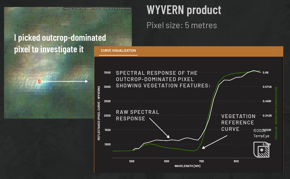
Detecting an outcrop is one thing, another thing is detecting what minerals are present within it.
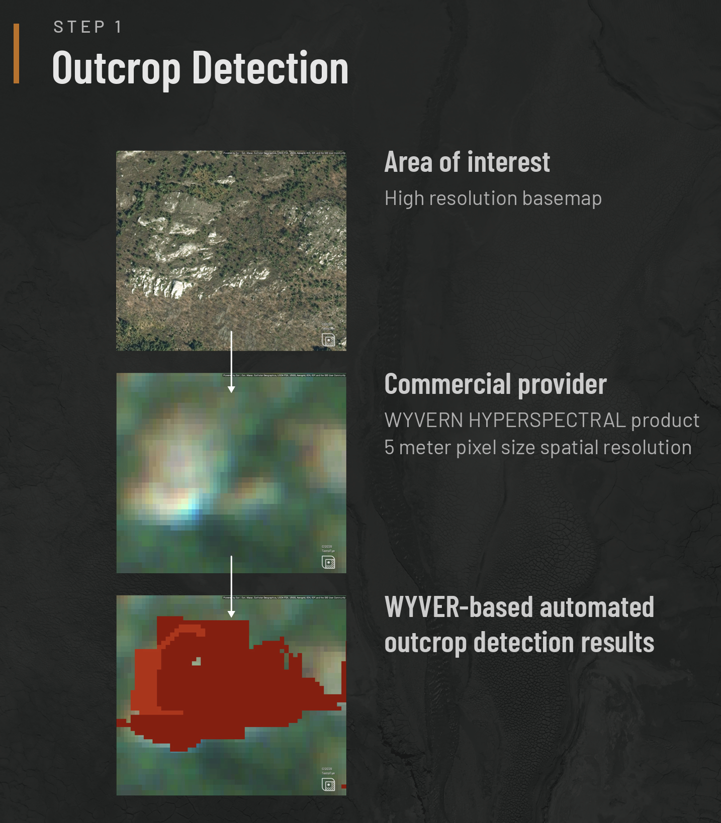
In today's case I want to highlight what are the scenarios for areas, where limited, <10 metres outcrops are the only geological features to be mapped. These are mostly too small to be detected using Sentinel-2, open access spectral data with smallest available pixel - 10x10 metres. This is where we use higher spatial precision datasets - it this example - WYVERN Dragonette.
WYVERN's Dragonette is a 5-meter spatial resolution, VNIR-only hyperspectral product. It offers enough detail to attempt this type of outcrop detection but raised the question of whether locating the outcrop was enough to also identify what minerals might be present?
Phase 1: Outcrop Detection
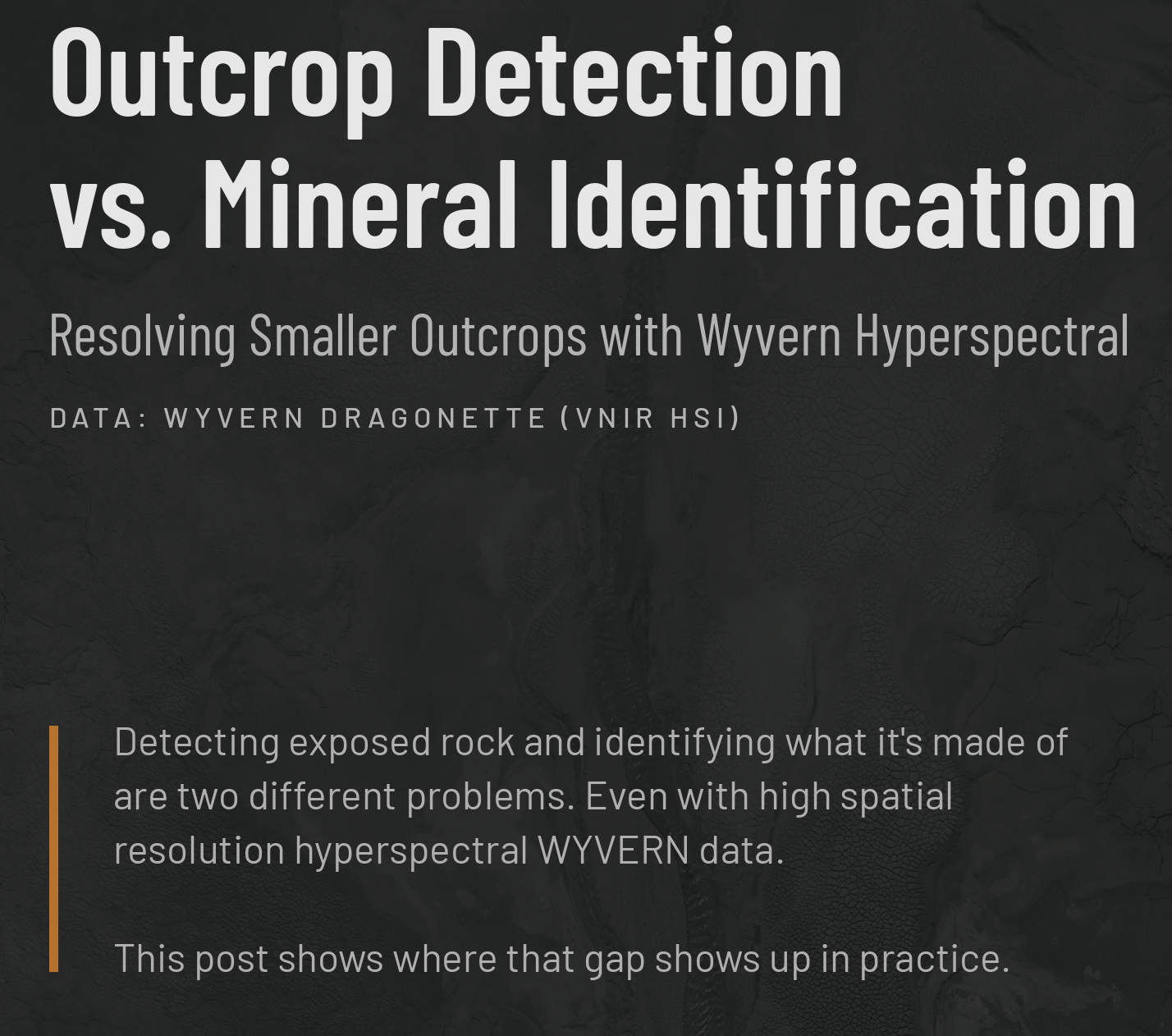
TerraEye's outcrop detection model, trained on reference pixels representing known outcrop locations, was applied to the WYVERN product to define where exposed rock is located. This phase succeeded, correctly delineating most of the outcrop extents.
Phase 2: Spectral Mineral Mapping
The next step was to examine the spectral response within the detected outcrop. My approach was that potentially I could catch spectral features coming from minerals which exhibit VNIR absorption features like goethite or hematite. But quickly I found out that this wouldn't be the case here. All I saw on the curves was a red-edge feature coming from vegetation influence, potentially moss, masking the underlying material's response.
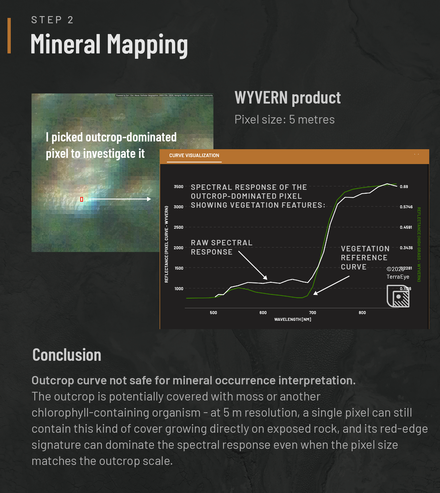
WYVERN is a VNIR-only sensor, so it can only diagnose minerals with absorption features in that range, excluding the many alteration minerals diagnostic in the SWIR. Here, the pixel's curve tracked a vegetation reference rather than a mineral-diagnostic response.
The conclusion here is that commercial data can be essential in specific cases, but it doesn't always deliver a complete answer that we would like to get.. ;)
-
Spectral Geology Thursdays is a series for everyone involved in mineral exploration or just curious about the use of remote sensing in geology. I'll be sharing short posts offering insights into what it's really like to work with satellite spectral data.
Credit: Magdalena Laban- Cieślik
Original Post
https://lnkd.in/p/dZKp3dbH