Unlocking Hidden Potential: How TerraEye Helped Kuya Silver Explore the Bethania Region
At TerraEye, we believe that modern exploration requires more than boots on the ground. It requires fast, accurate, and scalable intelligence that helps mining companies focus their resources where it really matters. Our recent collaboration with Kuya Silver at their Bethania project in Peru illustrates how satellite data and AI can work hand-in-hand with traditional geology to accelerate discovery.
A Historic Mine in a Complex Setting
The Bethania Silver Project is no stranger to exploration. First exploited as early as the 1600s, it has gone through cycles of small-scale and modern mining before Kuya Silver took ownership in 2020 and restarted operations in 2024.
Located in Peru’s Cordillera Central, Bethania sits within a geologically diverse terrain that hosts a variety of mineral systems: epithermal silver and gold, porphyry copper-gold, and skarn zinc-copper deposits. It’s a promising yet complex region—rich in potential but demanding a smarter approach to targeting.
TerraEye’s Approach
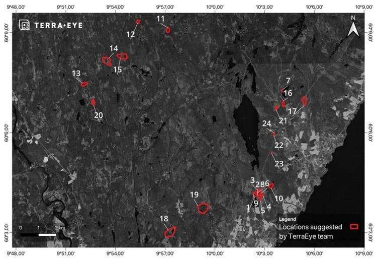
To support Kuya Silver, we expanded our analysis well beyond the mine footprint, covering nearly 1,850 km² of terrain. Our goal was to deliver reconnaissance-level insights that could guide Kuya’s geologists toward the most prospective areas for field validation.
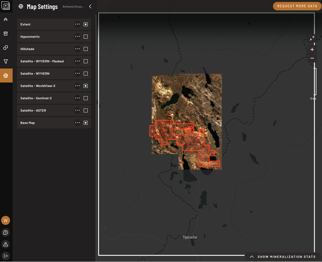
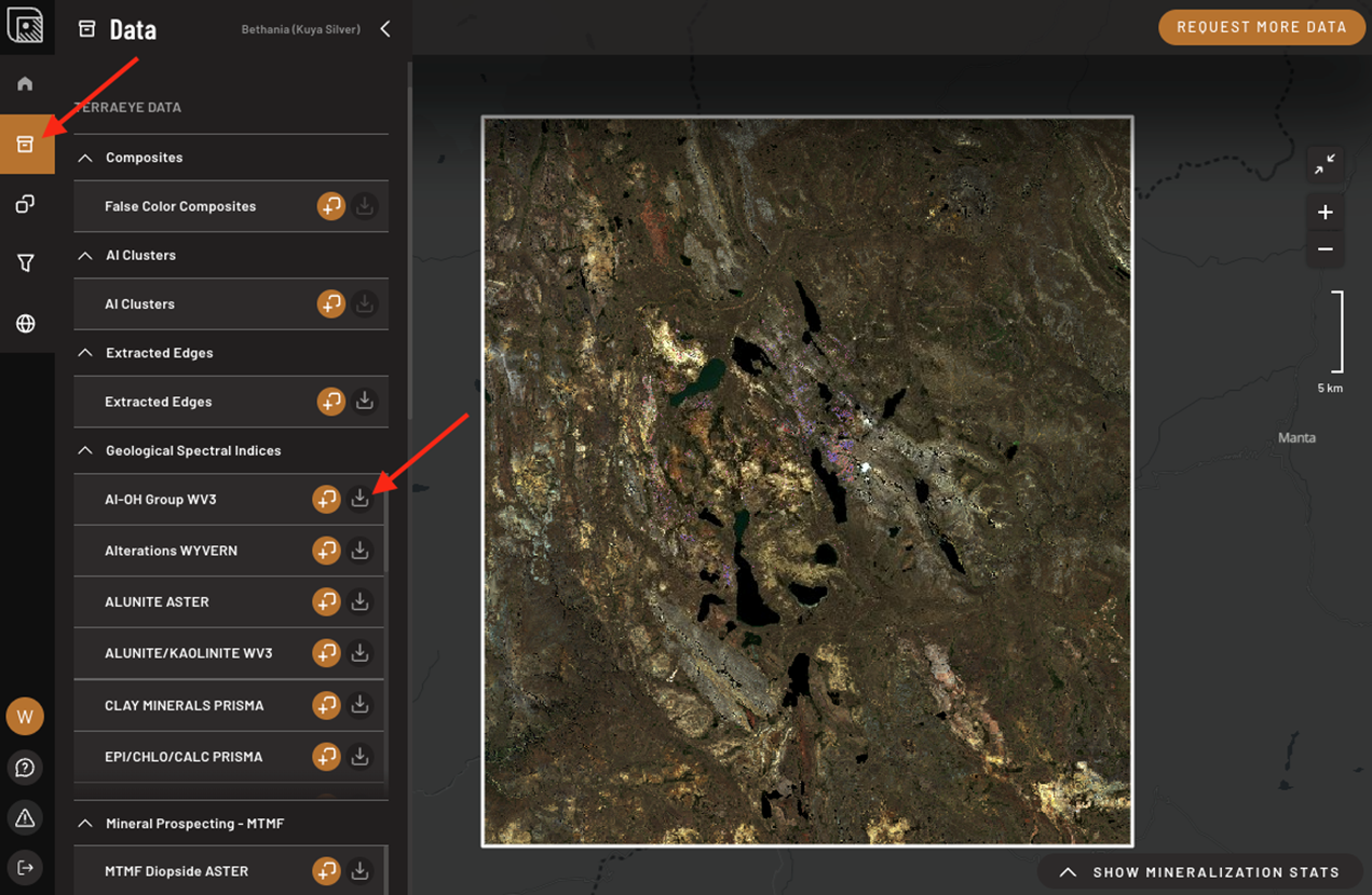
We combined multiple satellite datasets—ranging from high-resolution WorldView-3 to hyperspectral missions like PRISMA, EnMAP, and WYVERN, along with multispectral Sentinel-2 and ASTER. Each contributed unique strengths, whether in mineral identification, spectral resolution, or regional coverage.
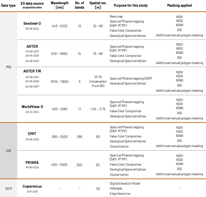
On top of this, we applied a toolbox of analytical methods:
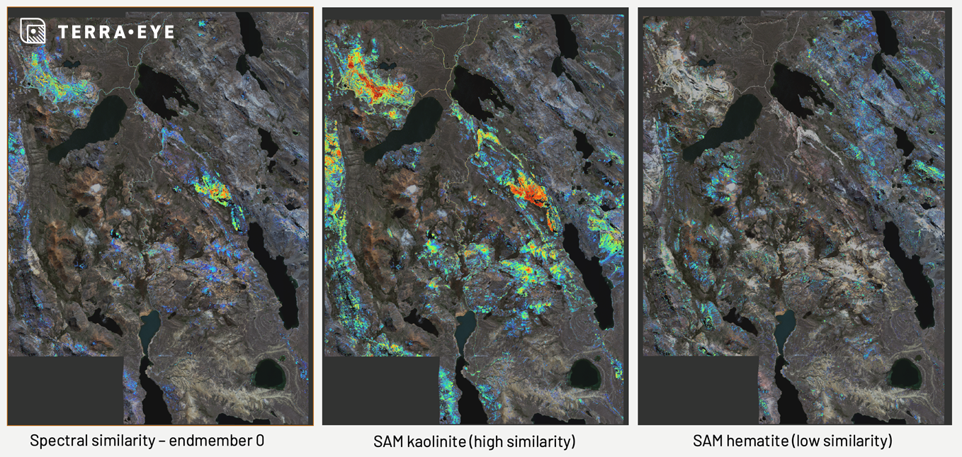
- Spectral Angle Mapper and Mixture Tuned Matched Filtering to identify mineral signatures such as clays, micas, sulfates, and Fe-oxides.
- Spectral indices and false-color composites to highlight alteration patterns invisible to the naked eye.
- AI clustering to reveal spectral patterns linked to geological structures.
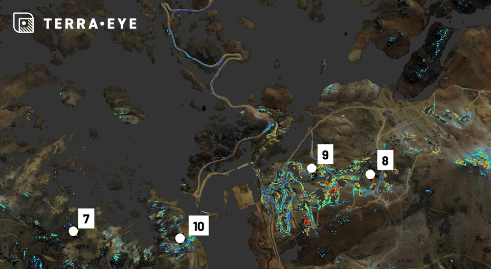
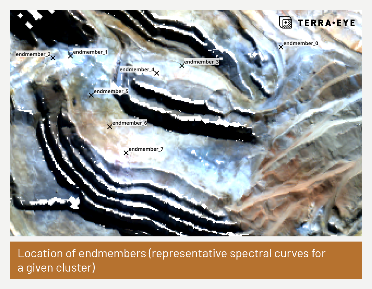
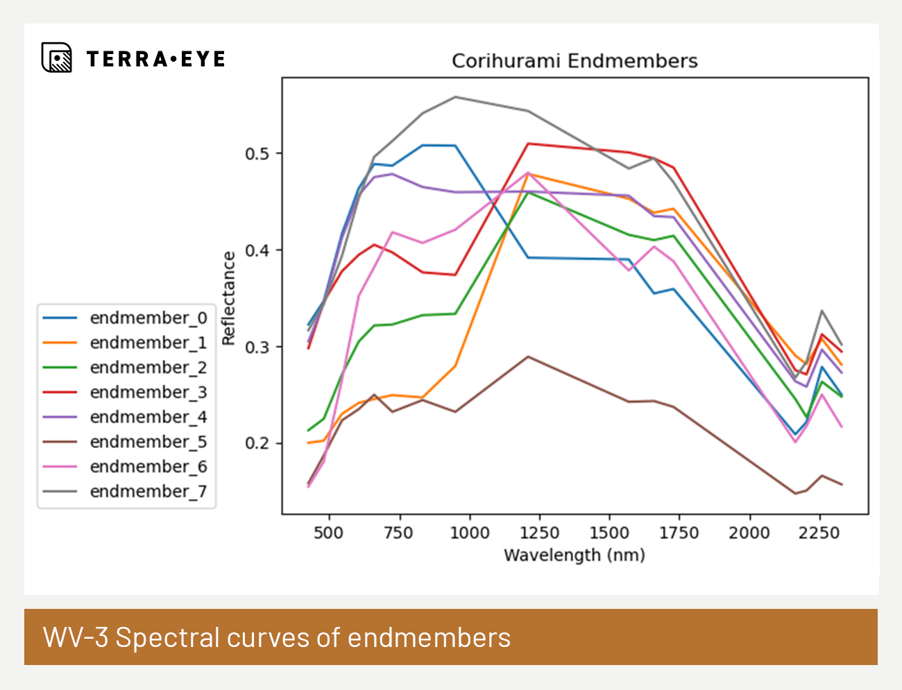
Spectral similarity mapping, using Peru’s Corihuarmi mine as a reference analogue, to identify zones that resemble known productive systems.
And finally, our AI Spectral Targeting, which integrates multiple mineral indicators into explainable target zones.
The Results
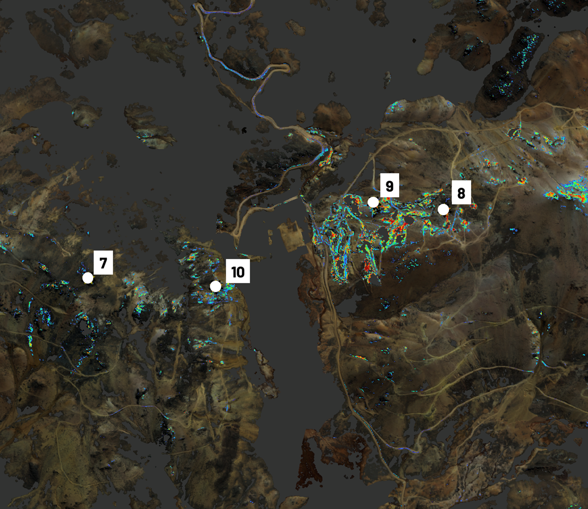
The outcome was a rich picture of Bethania’s mineral potential. We found widespread Fe-rich minerals such as goethite and hematite, as well as clay and mica assemblages (kaolinite, montmorillonite, illite, muscovite) across multiple hotspots. Sulfate minerals like jarosite and alunite were identified both near Lake Huarmicocha and in areas resembling the Corihuarmi mine. Carbonates and quartz-rich lithologies added further evidence of hydrothermal and epithermal processes at work.
Perhaps most importantly, the spectral similarity analysis revealed areas at Bethania that resemble alteration systems at Corihuarmi—a known high-sulfidation deposit. Our AI targeting confirmed these zones, pointing to consistent overlaps of clays, micas, and Fe-minerals, which are classic indicators of epithermal silver-gold mineralization.
Why This Matters for Geologists
For Kuya Silver’s technical team, these results provide more than just colorful maps. They are practical reconnaissance tools that can be integrated with geochemistry, geophysics, and structural data to build a stronger case for drilling. Delivered as QGIS-compatible layers, our data makes it easy for exploration geologists to overlay spectral targets with their existing knowledge and refine their field campaigns.
It is not a replacement for boots on the ground or spectrometer readings—but it is a powerful first pass that highlights where those boots should go first.
Why This Matters for Business Leaders and Investors
For Kuya Silver’s management and stakeholders, the value is equally clear. Remote sensing enabled the company to:
- Screen a vast region at a fraction of the time and cost of traditional exploration.
- Reduce risk by focusing resources on zones most likely to host mineralization.
- Accelerate the decision-making process, bringing the company closer to discovery and development.
- Strengthen investor confidence by showcasing the use of innovative, data-driven exploration strategies.
In other words, TerraEye helped Kuya Silver sharpen its exploration focus, conserve capital, and move faster toward building long-term value.
Looking Ahead
The Bethania project highlights what’s possible when advanced satellite analytics meet the realities of mineral exploration. By combining geology, AI, and cutting-edge Earth observation, TerraEye provided Kuya Silver with a clearer picture of where the real opportunities lie.
We’re proud to support Kuya Silver on their journey and excited about what comes next.
👉 Learn how TerraEye can help your project uncover hidden potential: