How TerraEye (with EUSPA) Helped Kuniko Get From Desk to Outcrop — Fast
In April 2025 we kicked off an EU Space demonstrator with Kuniko and EUSPA: take Copernicus data and show—in real field conditions—how it can speed up exploration. Three and a half months later, Kuniko’s team was already standing on rusty outcrops that matched our targets in Ringerike, Norway.
The challenge
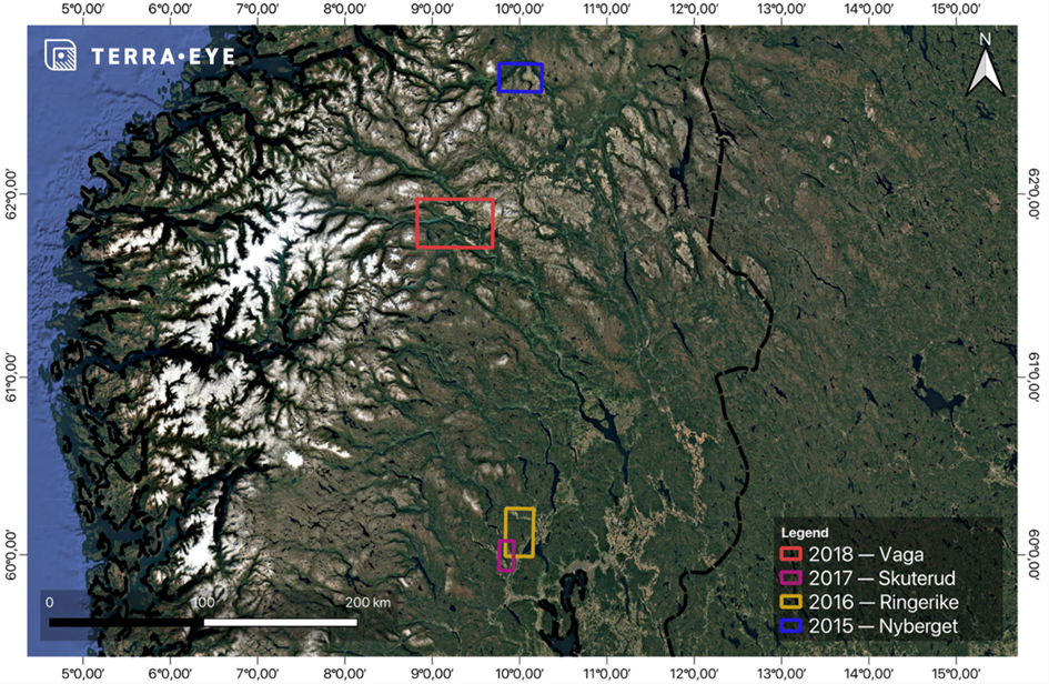
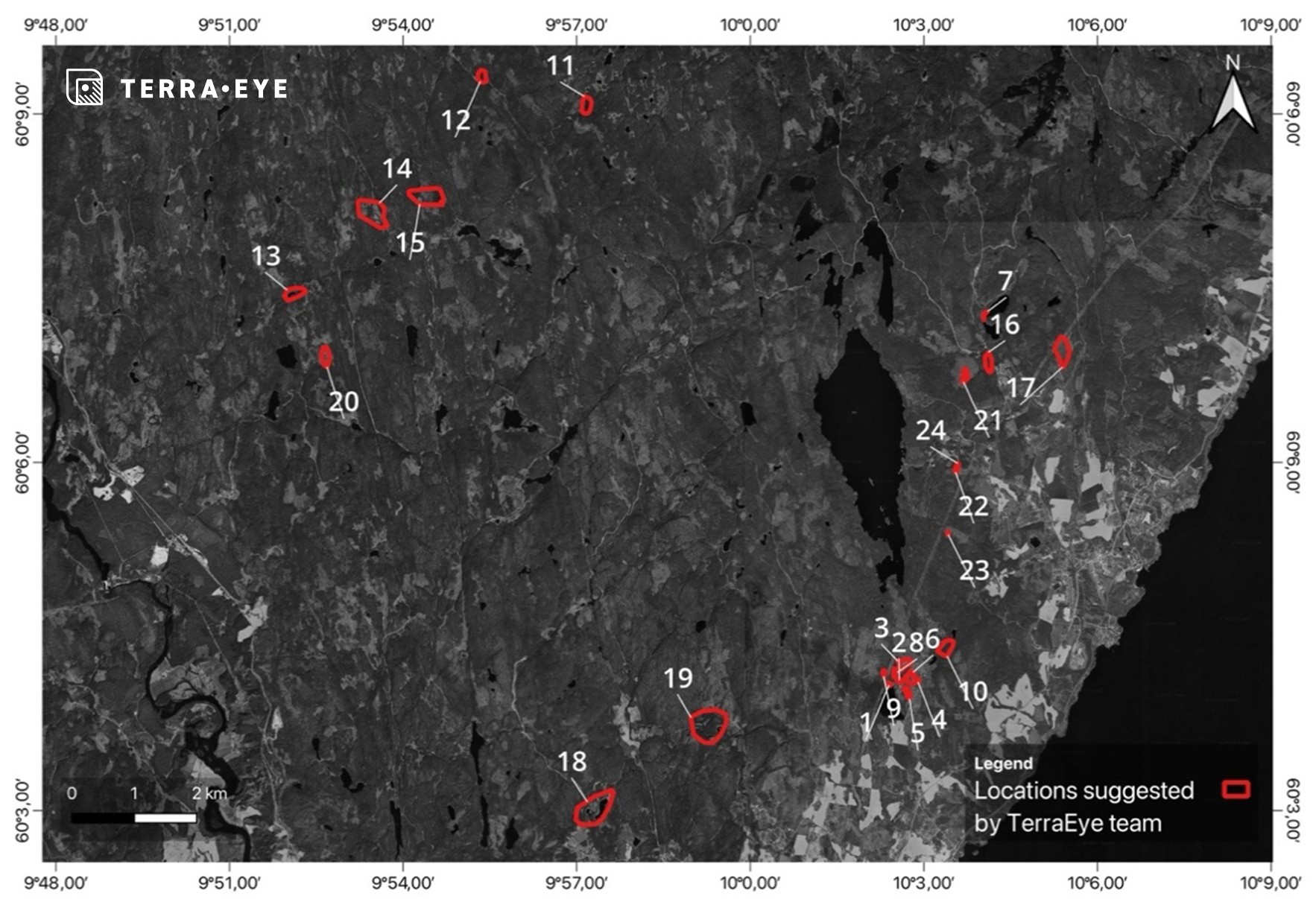
Kuniko’s concessions in southern and central Norway are a mix of forest, farmland, snow windows, and just enough rock exposure to keep geologists hopeful—and busy. Four areas were on the table:
- Nyberget & Vågå (VMS in basaltic rocks)
- Ringerike (Ni-bearing mafic intrusions)
- Skuterud (Co in sulphide-rich schists)
Ringerike and Skuterud are heavily vegetated, which is great for biodiversity and terrible for seeing geology from space. We needed a way to “clear the canopy” without touching a tree.
What we built
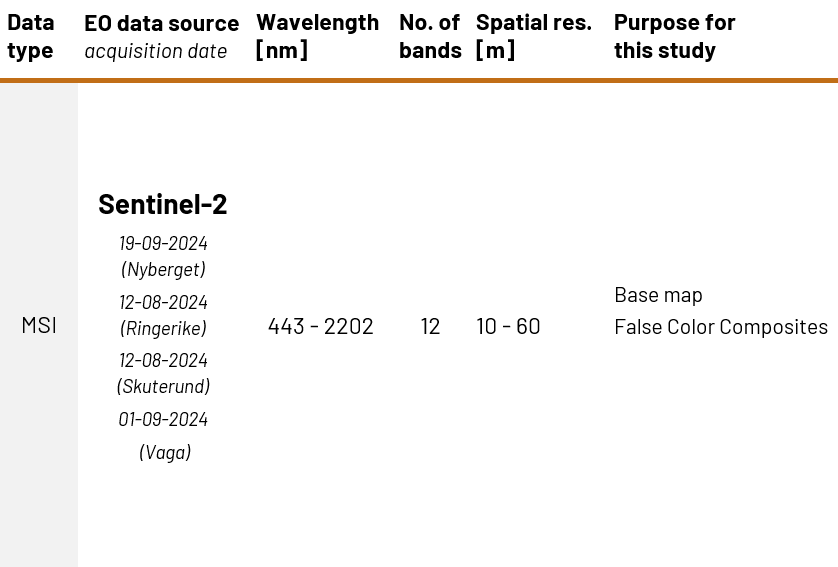
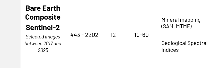
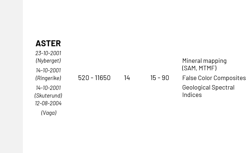
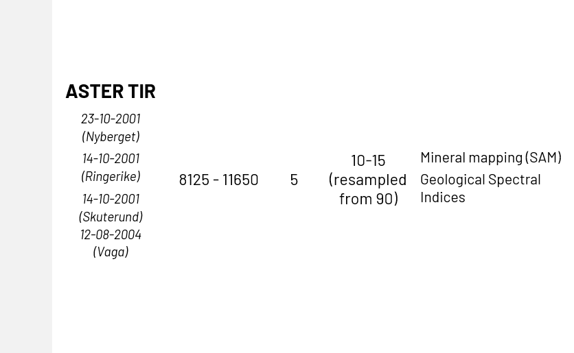
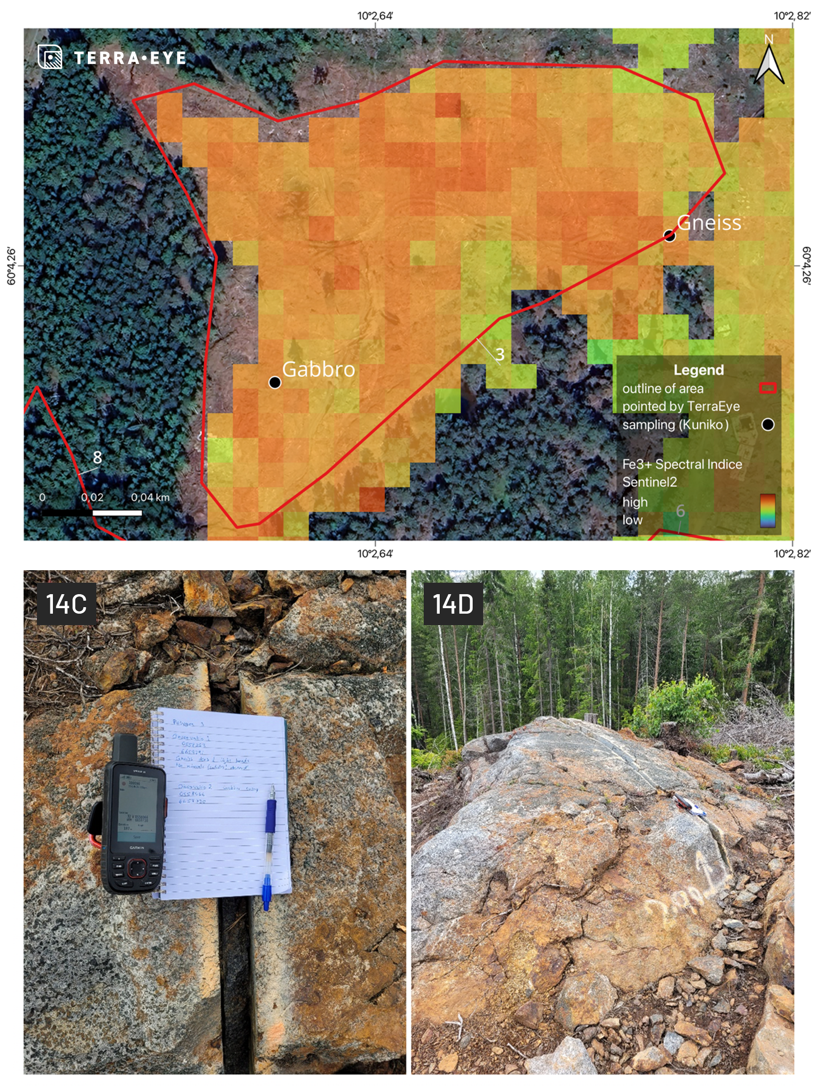
We used Sentinel-2 time series to create a Bare Earth Composite (BEC)—a stack of the “least vegetated” pixels across 2017–2025—then layered in ASTER (SWIR/TIR) and the Copernicus DEM for structure. That let us run mineral mapping only where rock or soil was actually visible, and add structural context where it wasn't.

A quick tour of the toolkit:
- Bare Earth Composite: masks out vegetation, snow, and water so we analyze exposed ground, not spruce tops.
- Mineral mapping: SAM and MTMF on + ASTER to highlight minerals and alteration relevant to VMS, mafic intrusions, and cobalt-in-schists.
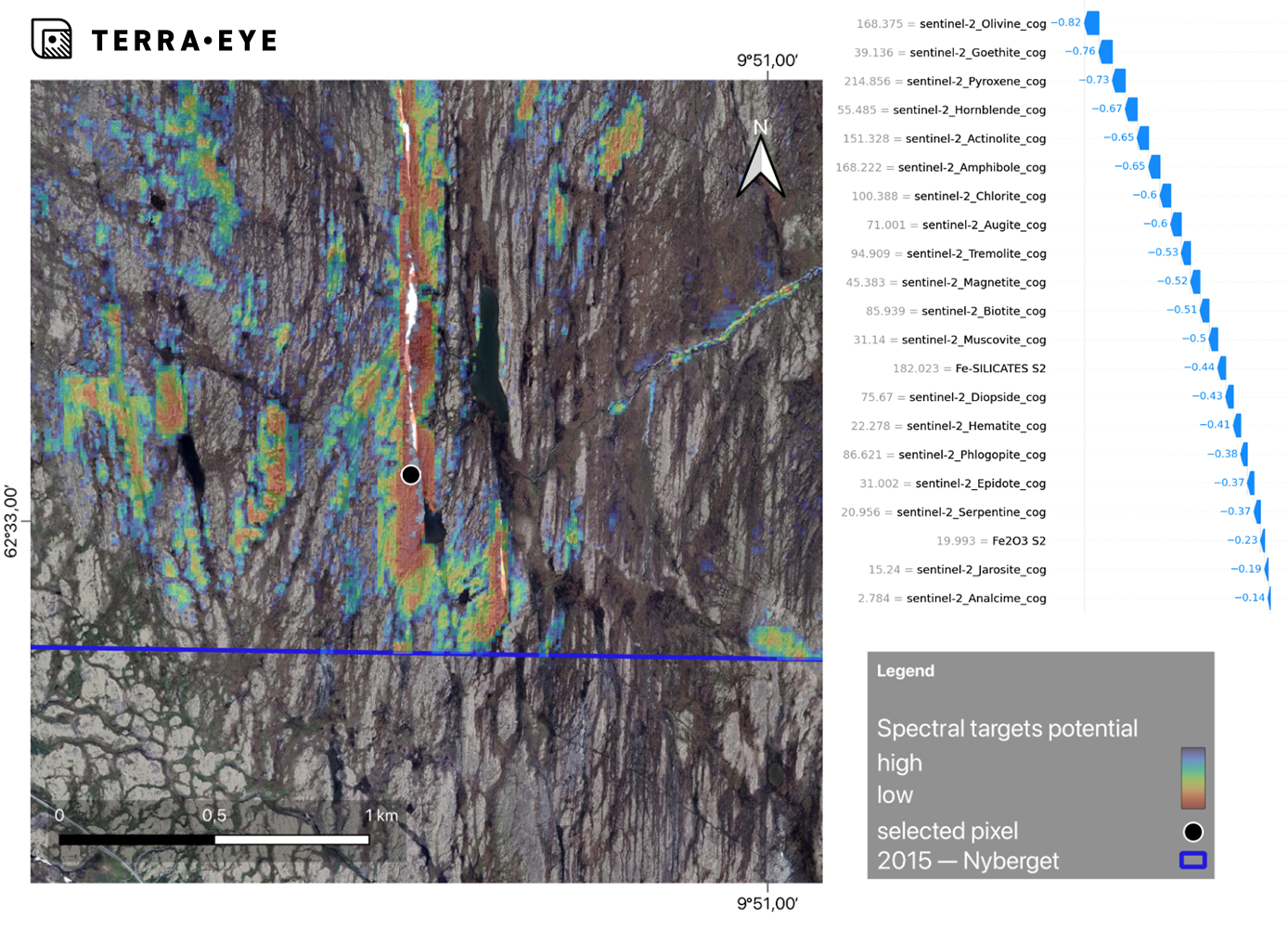
- Explainable targets: our Spectral Targeting view shows which layers (e.g., olivine, goethite, pyroxene) are driving a hotspot—useful for pre-field sanity checks.
- Vegetation PoC: a time-series workflow to flag metal-stressed vegetation (MSVI) near historical workings at Ertelien; think “hypothesis generator,” not a final verdict.
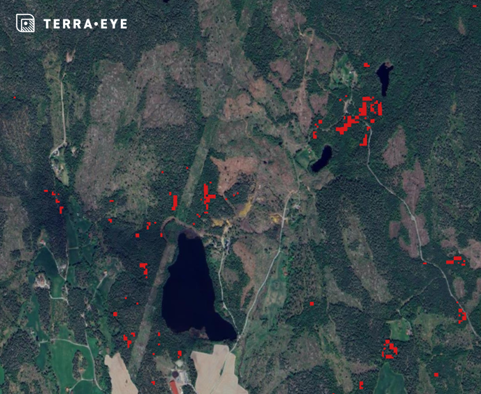
Final aggregated hotspots in the Ertelien area, displaying only pixels identified as hotspots in all analyzed scenes.
Under the hood we delivered large, reviewable layer stacks to Kuniko in-app of SAM/MTMF, indices and composites per AOI (e.g., Nyberget SAM≈63 / MTMF≈29). That’s a lot of evidence to agree—or disagree—with.
What happened in the field
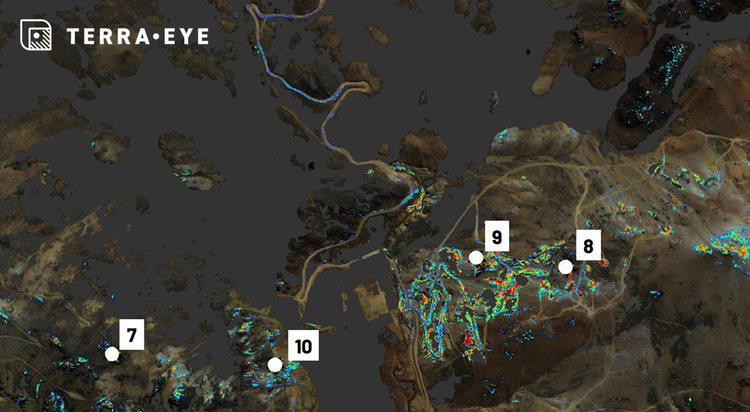
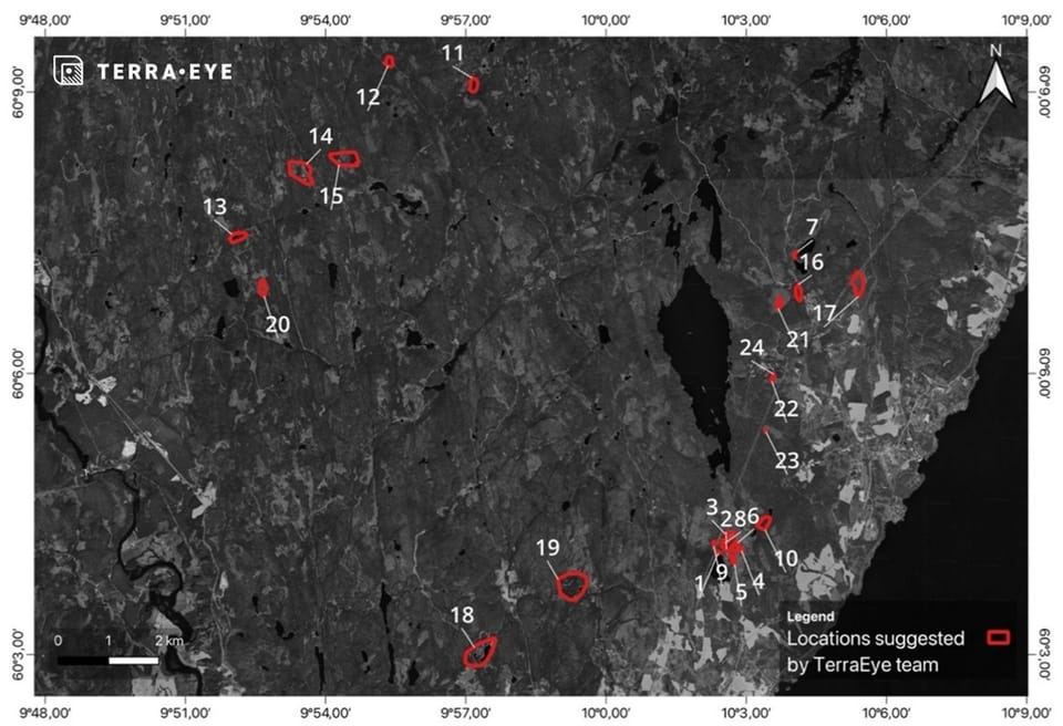
Before the trip, we suggested a small, practical shortlist that balanced spectral evidence with access. Kuniko checked seven locations across Ringerike/Skuterud—two for vegetation hotspots, five for mineral targets. The standout? Polygon 3: low vegetation cover, strong iron-oxide indices, and rusted outcrops with visible —exactly the kind of confirmation teams want early.
Across the five mineral-mapping checks, the desk-derived spectral analysis aligned with what geologists saw on the ground roughly 80% of the time. The vegetation-stress anomalies did what they were meant to do—point to persistent hotspots near legacy workings—but remain a PoC pending needle chemistry and soils.
Why it worked (and where it didn’t)
- We saw more of the ground. The BEC approach converted “too forested” into “just enough windows” to run mineral mapping at scale.
- We stacked evidence. SAM + MTMF + indices + DEM lineaments gave multiple reasons to care (or to be skeptical) about each pixel.
- We kept it explainable. Kuniko could click a target and see the spectral ingredients behind it, not a black box.
And the limits? Multispectral sensors aren’t hyperspectral—band depth matters. In conifer canopies, stress signals can be subtle, so our vegetation results are deliberately conservative until lab data weighs in.
What this means for exploration leaders
You don’t need a year to learn something new about your ground. In ~3.5 months (April–June 2025), Kuniko went from a blank satellite canvas to a handful of field-ready leads, plus a clear view of where to send the next dollar.
A few practical takeaways:
- Shortlist faster. Pre-compute layers, keep targets explainable, and you can plan smarter traverses in weeks—not seasons.
- Spend where it counts. Use satellite-guided clusters to decide where to task higher-res imagery, fly drones, or sample.
- Instrument your funnel. Track % of visited targets that show mineralization indicators (Kuniko’s early pass ≈80% on five sites), and your cycle-time from desktop start to first validation.
What’s next
- Fold in Kuniko’s geochem/geophysics to re-rank clusters and refine endmembers.
- Target top clusters with GSD or hyperspectral where feasible; run drone hyperspectral over two or three priority zones.
- Take the MSVI hotspots to the lab—needle chemistry, soils—and promote the workflow from PoC to decision-grade where it proves out.
A note on partners
This demonstrator was made possible by EUSPA (“Copernicus for the automated detection of resources”) and Kuniko’s collaboration—from data sharing to field validation. It’s exactly the kind of public-private handshake European space data was built for.
Want to see your AOIs the same way? We’ll load your licenses into TerraEye, build Bare Earth Composites, and hand you an explainable shortlist you can test on your very next trip.