
AI Spectral Targeting for Mineral Exploration
Define your exploration area, target minerals, and any known reference locations, agree on scope — TerraEye handles the full analysis and interpretation done by P.Geo and PHDs.
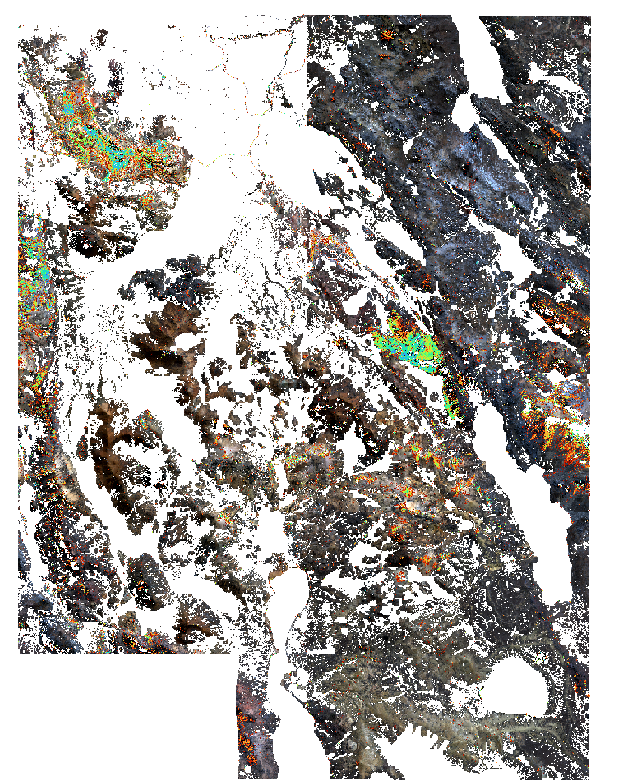
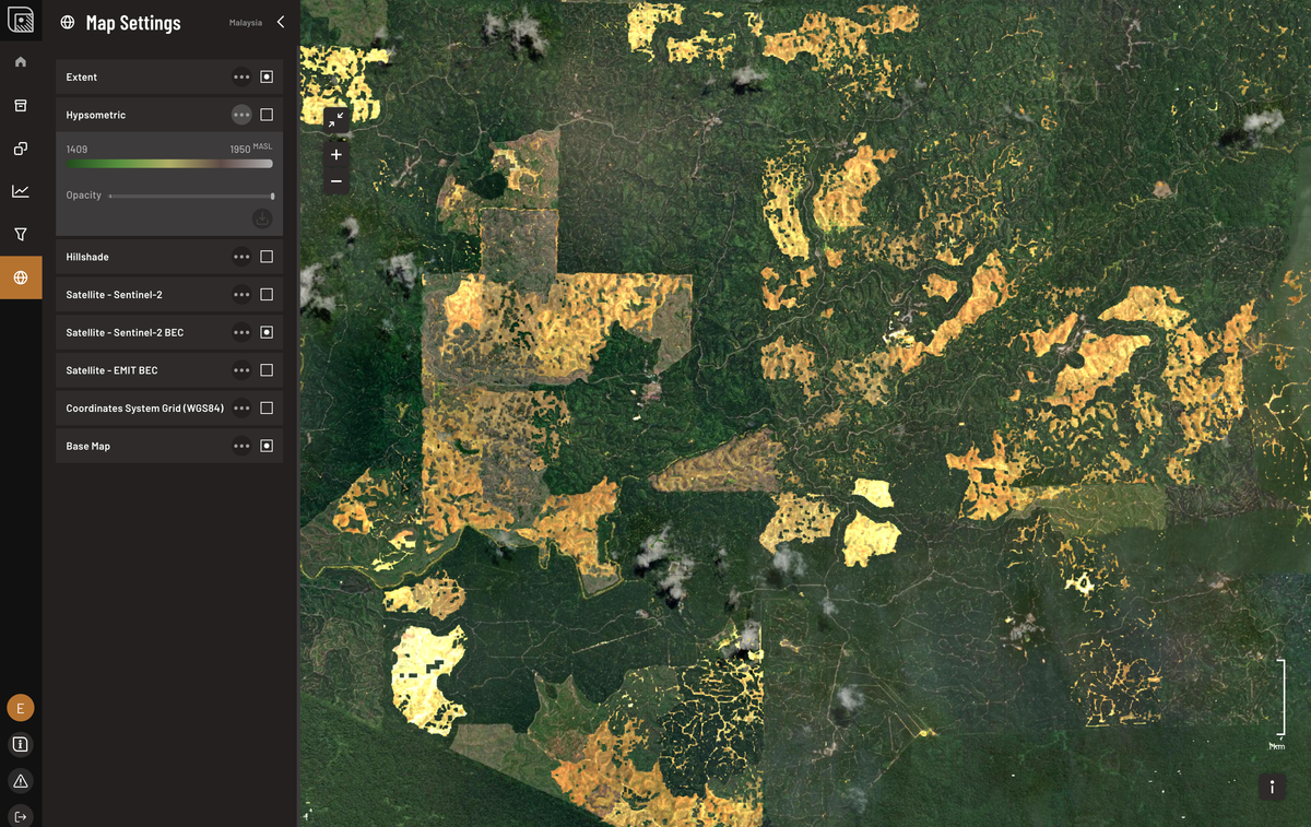
Multi- and hyperspectral satellite data reveal mineral and alteration signals often hidden from direct observation. In complex terrains, field access can be limited, but spectral workflows allow identification of gossans, clays, and subtle alteration patterns across your claims.
TerraEye’s AI identifies mineral and alteration signatures across your project area. The resulting spectral target maps highlight zones likely to host mineralization or alteration, providing actionable guidance for mapping, sampling, and field verification — without requiring an internal remote sensing team.
We take full responsibility for data selection, processing, analysis, and interpretation, delivering field-ready results that integrate seamlessly into your exploration workflow. AI-supported algorithms process these signals and pinpoint the most promising sites for follow-up exploration.
Workflow Overview
1. Project Context & Reference Data
Define your area of interest, target minerals or alteration types, and known reference sites. Available bedrock and surface geology maps will be incorporated to support interpretation; if these are not available, we will source the necessary data to ensure robust analysis.
2. Data Fusion & Spectral Analysis
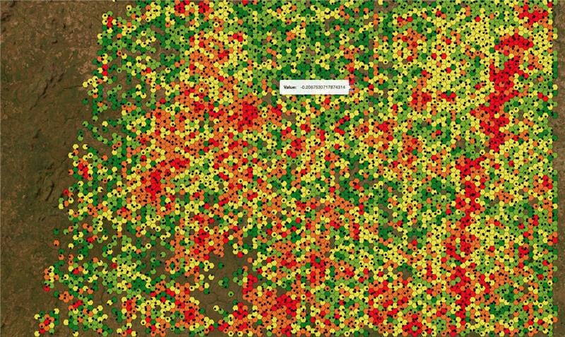
TerraEye ingests all relevant multi- and hyperspectral satellite imagery. Available spectral datasets are combined across different wavelength ranges to reveal subtle alteration patterns that single datasets often miss.
3. Spectral targeting
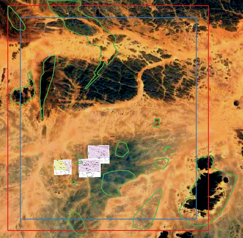
Reference sites guide the search for analogous mineral deposits, allowing us to focus on areas exhibiting spectral signatures consistent with known mineralization or alteration patterns. The full analysis is integrated into a spectral targets map, providing a clear spatial framework for decision-making in the field.
Each spectral target is accompanied by a detailed rationale explaining the underlying spectral signals and geological reasoning, along with practical recommendations for follow-up field work, including mapping, sampling, and verification. This ensures that every identified zone is actionable and can be efficiently prioritized within your exploration workflow.
4. How your project gains with TerraEye Spectral Targeting
- Use GIS-ready target layers (GeoTIFF, GeoJSON, KML, Shapefiles, QGIS-ready)
- Receive spectral target maps and similarity scores, highlighting areas most likely to match expected deposit types
- Explain which mineral signals drive each flagged anomaly in a concise, project-focused report
- Get a video briefing and geological consultation to guide interpretation and next steps
Key Outputs You Can Act On
High-resolution spectral target maps, similarity scores tied to reference locations, and report explaining why each zone was flagged — ready to integrate directly into your exploration workflow.
Visit TerraEye
Go to the app