
About TerraEye
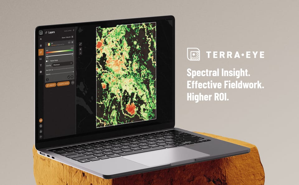
Satellite & AI-Based Spectral Targeting
Mapped zones with 80%+ field match.
Insights as a Service (IaaS)
Best for clients without in-house GIS or remote sensing teams.
- Define Your Area of Interest (AOI) & goals.
- We fuse satellite with geophysics, geochem & DEM data.
- Our spectral AI identifies mineralized zones (SAM, MTMF, clustering).
- You receive interactive maps, shapefiles, PDF reports & video briefing.
- Mobile app (coming soon) for guided field validation.
Software as a Service (SaaS)
Best for clients with in-house GIS or remote sensing teams.
- Use TerraEye modules independently.
- Upload your own AOIs and manage campaigns.
- Access up-to-date satellite data libraries and run custom analytics.
- Share across your team via TE:Connect cloud workspace.